Nordlandsruta
Nordlandsruta er en 650 km lang merket tursti langs grenseområdene mellom Norge og Sverige, og strekker seg gjennom Nordland fylke. Den er delt inn i 8 seksjoner bestående av 43 etapper med overnattingsmuligheter mellom hver etappe. Stien har flere innfallsporter, noe som gjør det mulig å gå en eller flere etapper om gangen. Ruten passerer gjennom tre nasjonalparker, Laponia verdensarvområde, 7 reinbeitedistrikt, seks samebyer og gjennom en rekke naturreservater.
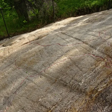
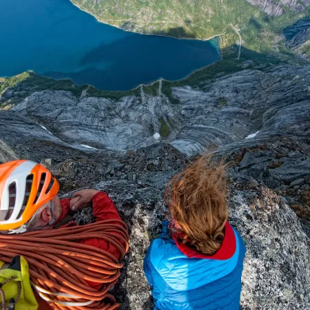
Naturskjønn utsikt til isbreen på Storsteinsfjellet, 1893 moh.
Zdeno Dvorak
En vandring gjennom Narvikfjellene
Reisen gjennom Narvikfjellene langs Nordlandsruta strekker seg over omtrent 94,9 kilometer og utgjør de høyeste delene av hele ruta. Vi befinner oss hovedsakelig i høyfjellsterreng, mellom ca 700 og 1000 moh. To av hyttene er plassert på en imponerende høyde på 1000 moh, og tilbyr en unik opplevelse i høytliggende omgivelser.
Etappen når sin makshøyde på 1226 moh, som markerer det høyeste punktet langs hele ruten. Den første delen av reisen fører oss gjennom daler, og går gradvis ned til Katterat før oppstigningen til det fantastiske høyfjellsterrenget begynner.
Turbeskrivelse
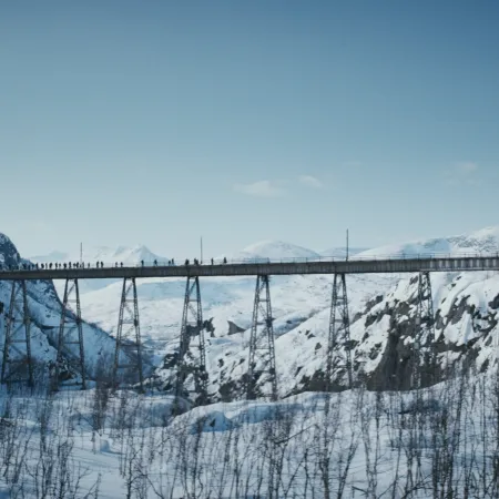
To reach the starting point of this section at Bjørnfjell, you can take the train from Narvik or drive on E10 from Narvik or Kiruna. This section follows the Rallarveien (Navvies' Road), marked on the south side of Bjørnfjell station. Rallarveien traverses easy terrain with a gravel surface. After approximately four kilometers, you'll arrive at Søsterbekk. Take the trail to the right if you want to make a detour up to the small station building at Søsterbekk halt. Here, the track splits into two, with the older part crossing the high Norddalsbrua, which you will pass along the Rallarveien. The bridge was constructed following a demand from the Norwegian defense authorities, and it was intended to be blown up if Russia invaded Northern Norway. Following Rallarveien further may be a bit challenging. Now you must navigate through a steep and landslide-prone section, but in return, you'll have a spectacular view of Norddalen. The Ofotbanen (Ofoten Railway) follows below the road, mostly through tunnels and avalanche shelters. Along the way, you'll also pass a magnificent waterfall. You need to cross the railway line and continue on the steep trail down the mountainside. Shortly after crossing the railway line, you'll reach Vokterboligen.
You can find a map of the section HERE.
Experiences along the way:
- The Ofoten Railway runs alongside the trail.
- Experience the 130-meter-long Norddalsbrua, towering 40 meters above the ground at its highest point.
- Spectacular views of Norddalen.
Follow the Rallarveien (Navvies' Road) down the slope until it crosses over the Hunddalselva on a bridge. Then, turn off from Rallarveien to the left after the bridge. The trail goes uphill along the river and winds its way to Katterat station. If you take the path to the right after the bridge and continue along Rallarveien, you'll end up in Rombaksbotn.
You can see a map of the section HERE.
Experiences along the way:
- Traces of buildings constructed here in the early 1900s.
- Old station buildings at Katterat. They are now used as cabins.
- From Katterat station, you have a view towards Rombaksbotn.
- "Katteratgubben" is a roughly 4-meter-high rock formation located about 50 meters west of the railway station area. Despite its approximately ten-ton weight and balancing on another rock, it has not collapsed despite two tunnel blasting projects nearby.
Follow the construction road from Katterat northwards up Sørdalen/Beatnatvuopmi and further into Hunddalen/Beatnatvággi almost to the end. Just west of Sjufemtenhøgda, the route to Cunojavrihytta diverges. At the end of the road, there is a cabin that is not Hunddalshytta. The trail to Hunddalshytta branches off just before this cabin, and then there is about 900 meters left. Here, there is also a trail junction leading to Cunojavrehytta and Lossihytta.
Alternatively, you can take an unmarked route over Langryggen/Cáicačorru. If you choose this option, you should expect about 1 hour longer. Initially, follow approximately 500 meters along the construction road. Then, turn right at the water reservoir and follow a well-unmarked trail southward beneath Hunddalstoppen, past Karlsenvatnet, Langvatnet, and Krokvatnet on the east side. Continue diagonally down towards the end of Passmyra, onto the construction road, and further on the marked route.
You can see a map of the section HERE.
Experiences along the way:
- Hiking along Hunddalselva.
- Hiking in a valley surrounded by mountains ranging from 1200 to 1400 meters in height.
Follow the trail back approximately 900 meters along Hunddalselva to a trail junction just west of a private cabin and dam. Then, take the trail to the right that crosses over Hunddalselva below the dam. Shortly after the dam, a trail branches off towards Losishytta, but you continue straight ahead. The trail then rounds Nordbergryggen/Sillesčorru and enters the valley, continuing along several small lakes before reaching a resting cabin. You should be prepared to wade through a shallow water area between two of the lakes. About 1 km before the resting cabin, the trail intersects with a path from Katterat via Djevelpasset. The resting cabin, named Oallavagge, has two beds and is operated by the Narvik and surrounding areas tourist association. Follow the trail further on the east side of two larger lakes and up through Oallavággi, passing the east end of Sealggasjávri. Then, the trail goes on the east side of Sealggjohka. About 1 kilometer before Cunojávri, there is a trail junction where the path to the east leads to Unna Allakas, while The Nordland trekking trail continues straight south, crossing the river on a bridge.
You can see a map of the section HERE.
Experiences along the way:
- Hiking along a series of mountain lakes.
- Views over the approximately 1-mile-long lake Sealggasjávri.
- Glimpses of the 1689-meter-high mountain Ristacohkka with its associated glacier.
From Cunojávrihytta, there are two trails heading west. Follow the southernmost trail, which runs closest to the water, and crosses the bridge at the north end of Ákšoluoppal. The trail then continues southwest in flat and gently rolling terrain, south of the small mountain top Báidedievva. The path crosses Gállanjohka and Kalikselva/Cáihnajohka before passing through the valley of Orjjescáihna, past lake 933, and down to Cáihnavaggi. Both rivers need to be forded. If Kalikselva cannot be forded, follow the river downstream for 1.5 km to a bridge south of elevation 728.
You can see a map of the section HERE.
Experiences along the way:
- Fording across rivers.
- Views towards Storsteinfjellet at 1893 meters above sea level.
- Views towards the glacier massif around Storsteinfjellet.
From Cáihnavággihytta, the trail winds southwest between the Skjomenfjellvatnan/Čáihnajávrrit. Initially, the trail goes on the north side of lake 1001 and then on the south side of lake 1090 before ascending the slope to Nordlandsruta's highest point at 1206 meters above sea level. This point is located in a valley between majestic mountain peaks. On the way to this point, two streams/rivers must be forded. The trail then continues through the valley. On the descent, you reach a trail junction. The path to Gautelivatnet/Guovdelisjávri goes to the left, navigating through gently rolling terrain before rounding the nose of Várdahančohkka and proceeding to Gautelsihytta. From the trail junction, it's approximately 5.5 km. Opting to go to Gauteslihytta means a detour of about 7.5 km in total.
You can see a map of the section HERE.
Experiences along the way:
- Hiking at altitudes above 1000 meters.
- Fording across rivers/streams.
- Close encounters with majestic mountains.
From Gauteslihytta, there is a trail heading west that closely follows Gauteslivatnet. After joining a trail from the northeast, the path rounds the northwest end of the lake. The trail crosses several streams/rivers, usually passable without fording. After rounding the northwest end of the lake, the trail joins a construction road, which is followed for about 2.5 km before the trail turns southwest. The construction road continues down to Skjomen. When leaving the construction road, the trail proceeds south of Øvre Kjørrisvatnet/Čoarddajávri and lake 1029. Then, the trail rounds the southwest side of Juovvačorru (1243 meters above sea level) before descending to Skoaddejávre.
You can see a map of the section HERE.
Experiences along the way:
- Hiking in an alpine mountain landscape.
- Close encounters with the regulated Gauteslivatnet. The lake is approximately 14 km long and about 3 km wide.
From Skoaddejávre, the trail heads northwest, running approximately parallel to the national border and descending until it intersects with the gravel road about 2 km south of Iptojávri. From here, follow the gravel road for 13 km to Sitashytta. Shortly after reaching the gravel road, it turns south and enters Sweden, rounding Coadgecorru (1054 meters above sea level) before returning to Norway at the southern end of Tjårdavatnet/Coadgejávri. Afterward, it swings back into Sweden, reaching the northwest end of the enormous border lake, Sijdasjávrre. About 1 km before the cabin, the gravel road enters Norway again. The final part of the gravel road is a toll road.
You can see a map of the section HERE.
Experiences along the way:
- A hike in borderland.
- Close encounters with the 73 km² regulated lake, Sijdasjávrre.
- Seven border cairns located in close proximity to the trail.
Et bilde av de koselige hyttene på Cunojávri - midt i uberørt villmark.
Zdeno Dvorak
Bestille hytter
Du bestiller én hytte om gangen, og sørger for å fullføre bestillingen på den første hytta før du går videre til den neste. På noen hytter kan man reservere senger for drop-in-gjester. Besøk www.hyttebestilling.dnt.no for å sjekke tilgjengelighet og gjøre reservasjoner. Hytter som som ikke er tilgjengelige for bestilling på nett, finner du mer info om på www.ut.no.
De fleste hytter uten vert er sikret med DNTs standardnøkkel. Det anbefales å ha med denne lille nøkkelen i sekken når du er ute på tur. Medlemmer kan skaffe nøkkelen ved å betale et depositum på NOK 100 på Turistinformasjon i Narvik.
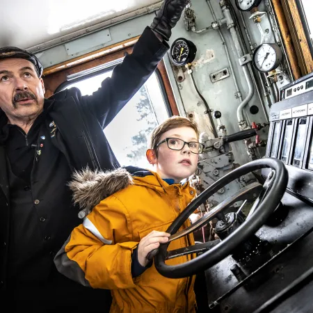
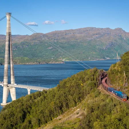
Togavgang fra Narvik togstasjon, starten på en fantastisk vandring i Narvikfjellene.
Michael Ulriksen
Innfallsporter
Det er flere måter å komme seg til de ulike etappene i Narvikfjellene, enten det er med tog, bil, ferge eller båt
Bjørnfjell stasjon er det viktigste startpunktet i Narvikfjellene. Tilgjengelig med bil eller tog fra Narvik og Stockholm, får du en god start på vadringsturen.
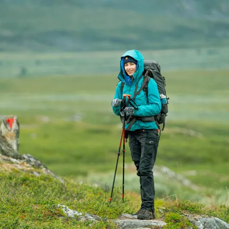
Gjør deg klar for en styrkeprøve i storslåtte naturlandskap..
Zdeno Dvorak
Forberedelser
Narvikfjellene har 94,9 kilometer med merkede turstier som slynger seg gjennom fantastiske naturlandskap og fjellandskap. Enten du foretrekker å ta for deg etapper, seksjoner eller hele strekningen i én tur, er valget ditt. Det er imidlertid viktig å merke seg at disse stiene er utfordrende, og krever utmerket fysisk form og kjennskap til røft fjellterreng.
For de som mangler nødvendig erfaring, anbefaler vi sterkt å starte med enklere fjellturer. Utforsk våre foreslåtte turer for et passende eventyr.